SnowJapanHistory スノージャパン ヒストリー
A look back at ski areas from Japan’s past 過去の日本のスキー場を懐かしむ
Aizubange Choei
Aizubange Town, Fukushima Prefecture
会津坂下町営スキー場 福島県会津坂下町
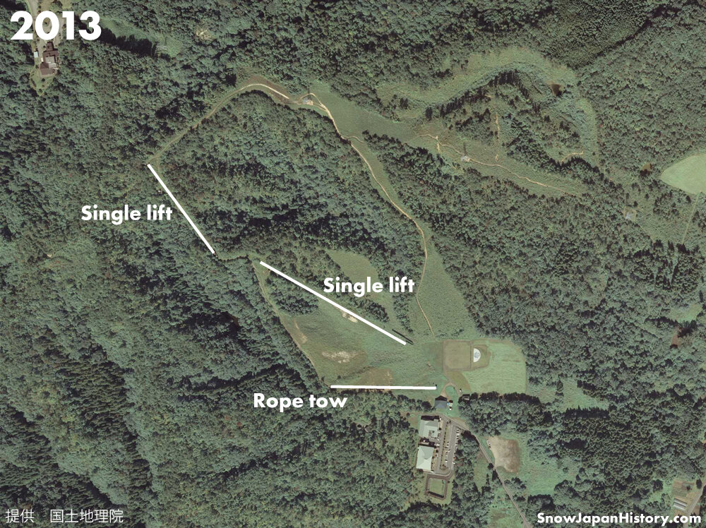
Aizubange Choei was a ski area named after the town where it is located - Aizubange Town, in the north-western region of Fukushima Prefecture. Choei basically means 'managed by the town'. Aizubange Choei featured two single lifts and two rope tow lifts, though the two singles were not in operation in later years. The east facing slopes offered views of the Aizu basin, looking over towards Mt Bandai and Inawashiro. After closing to the general public, it opened for ‘education purposes’.
Historic Aerial Photograph
Information on photographs and images used on this page can be found here
| Opened 開設 |
1976 | |
| Closed 閉設 |
2006 | |
| Base elevation 標高最低 |
220m | |
| Top elevation 標高最高 |
340m | |
| Vertical 標高差 |
120m | |
| Steepest slope 最大斜度 |
29° | |
| Number of courses コース本数 |
5 | |
| Longest run 最長滑走距離 |
About 1,000m | |
| Skill level 初級・中級・上級 |
Unconfirmed | |
| Ski / board スキー・ボード |
Unknown | |
| Ski lifts リフト本数 |
4 lifts (at one time) | |
| Single | 288m | |
| Single | 172m | |
| Rope tow | ||
| Rope tow | ||
| The lifts remain in place | ||
| Night skiing ナイター設備 |
There was night skiing, mostly on weekends | |
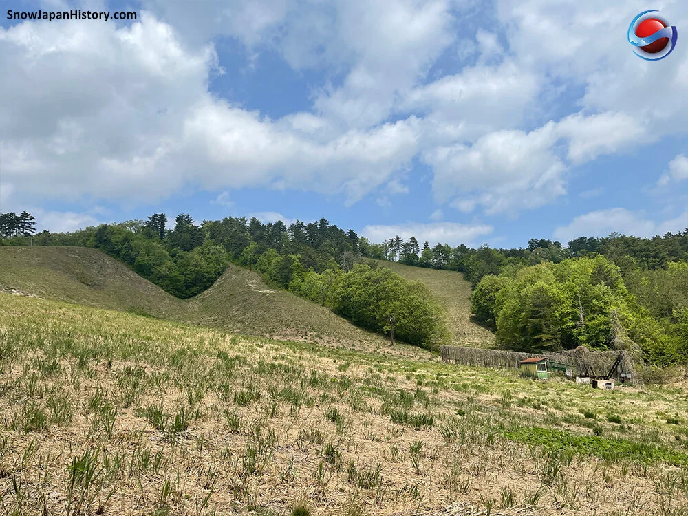
Photographs
Taken in May 2021
写真撮影:2021年5月


Further Information
|
Google Earth

Google Street View
Google Maps
Location
所在地
Located about 3km off Route 49 to the north west of the central area of Aizubange Town.
About 6km from the Aizubange IC exit on the Banetsu Expressway.
About 5km from Aizubange Station on the Tadami line.
磐越自動車道 会津坂下ICから的6km
只見線 会津坂下駅から的5km
Currently operating ski & snowboard resorts in the region
近隣の運営中のスキー場
This page was created in May 2020
Last updated on 11th August 2022
2020年5月 作成 2022年8月11日 更新