SnowJapanHistory スノージャパン ヒストリー
A look back at ski areas from Japan’s past 過去の日本のスキー場を懐かしむ

Sarugedake

Kamo City, Niigata Prefecture

猿毛岳スキー場 新潟県加茂市

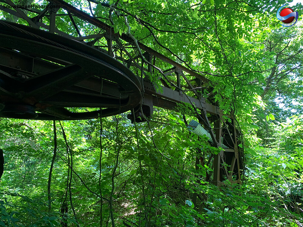
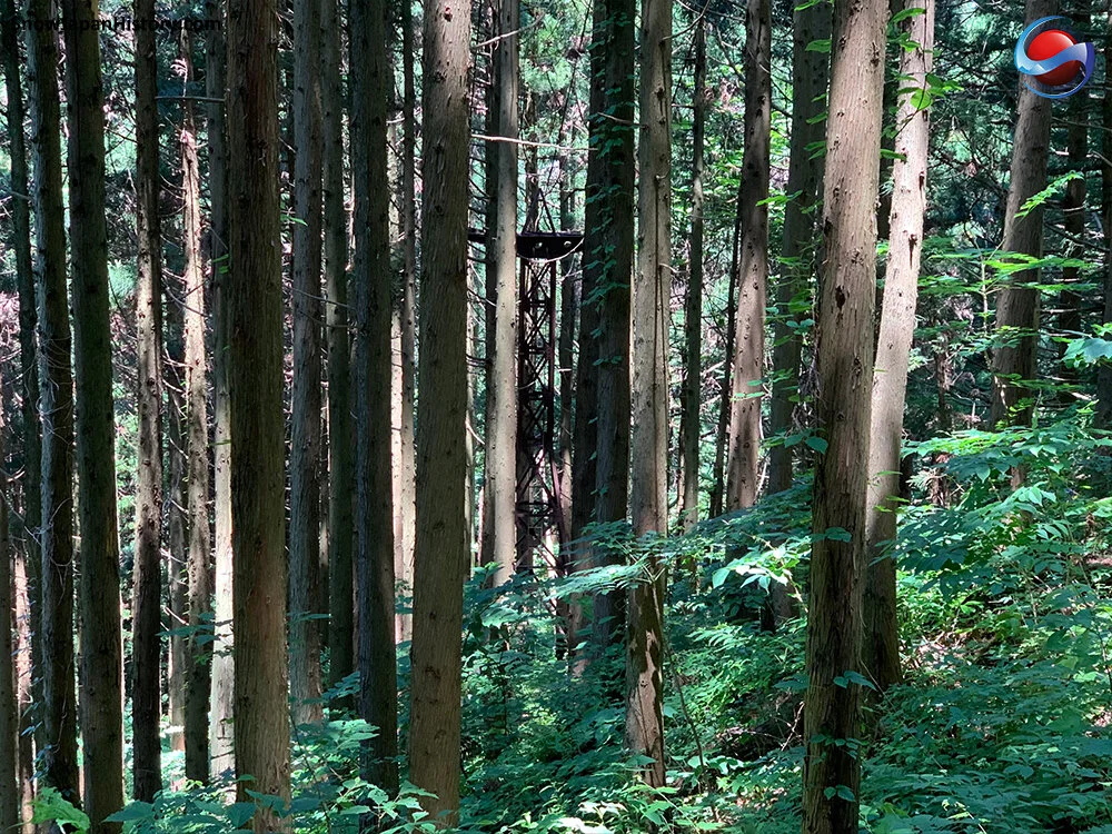
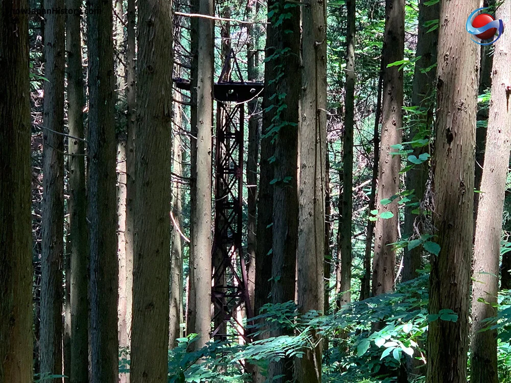
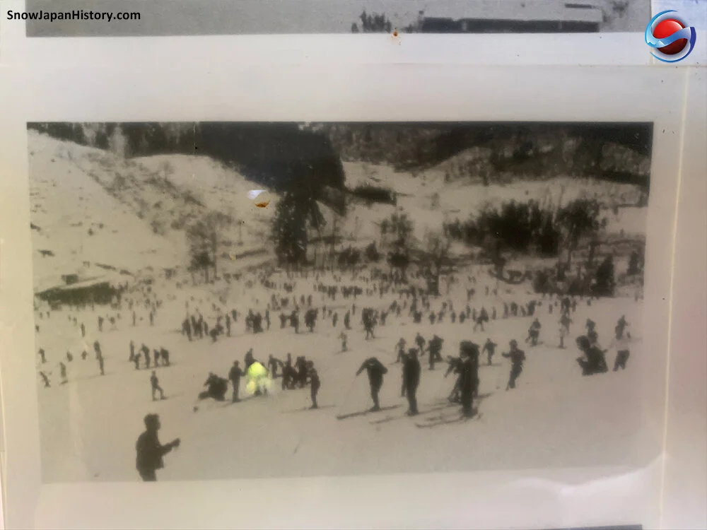
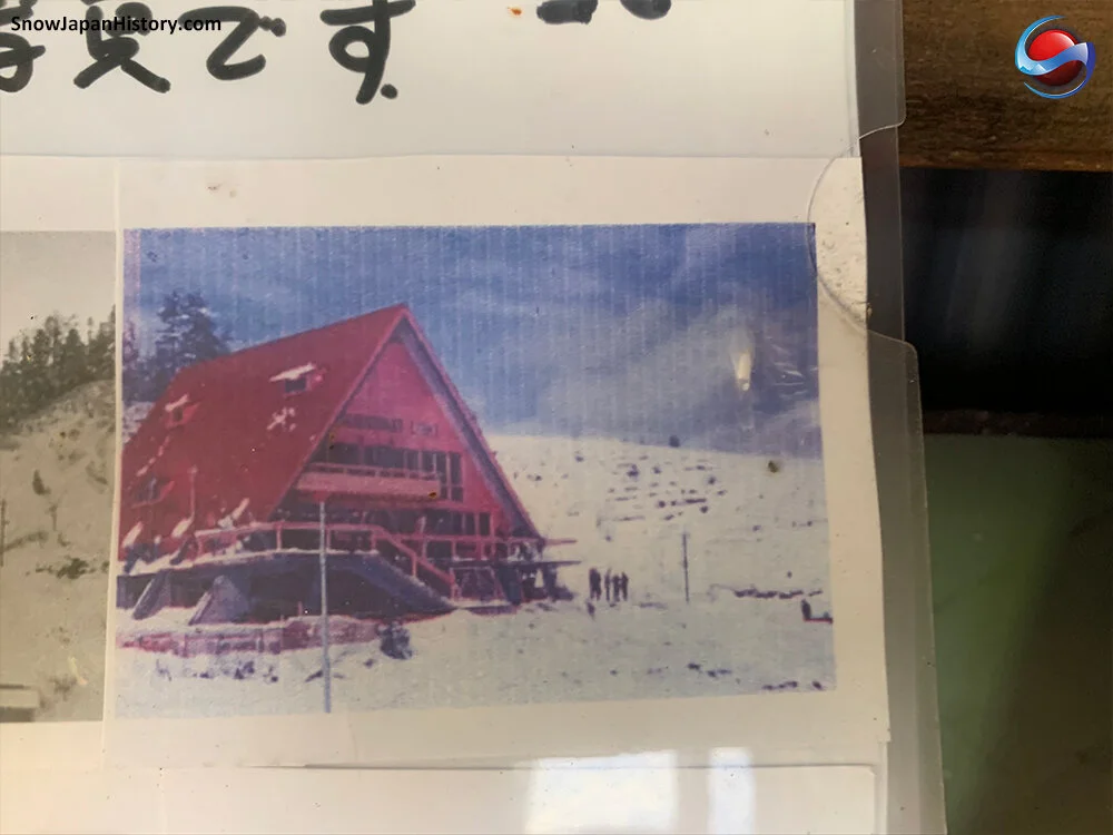
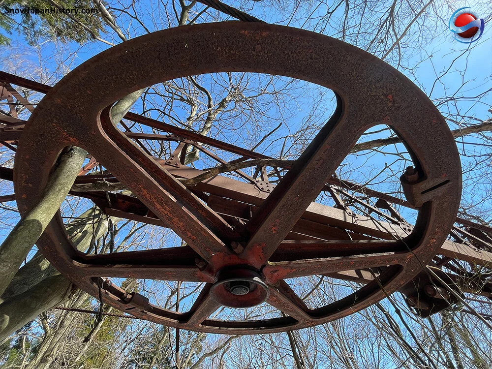
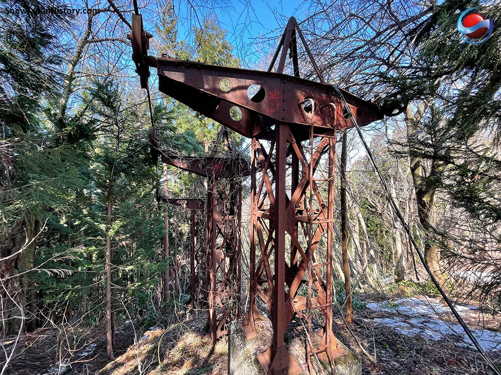
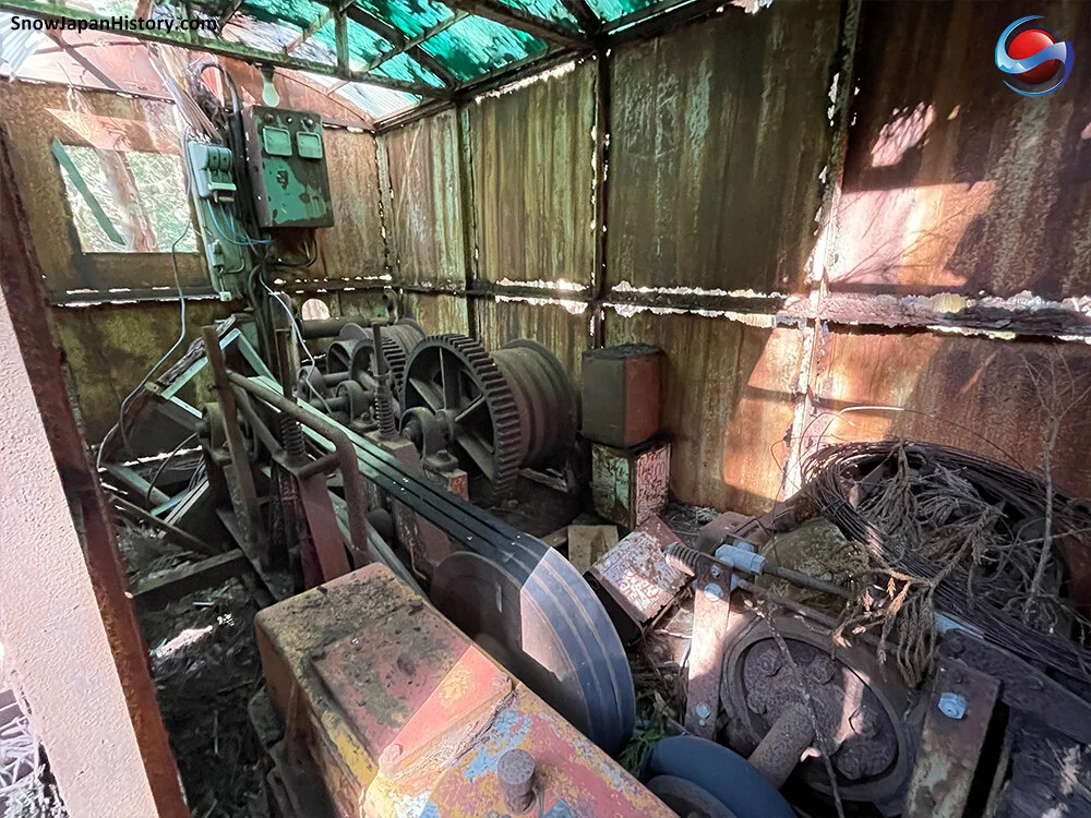
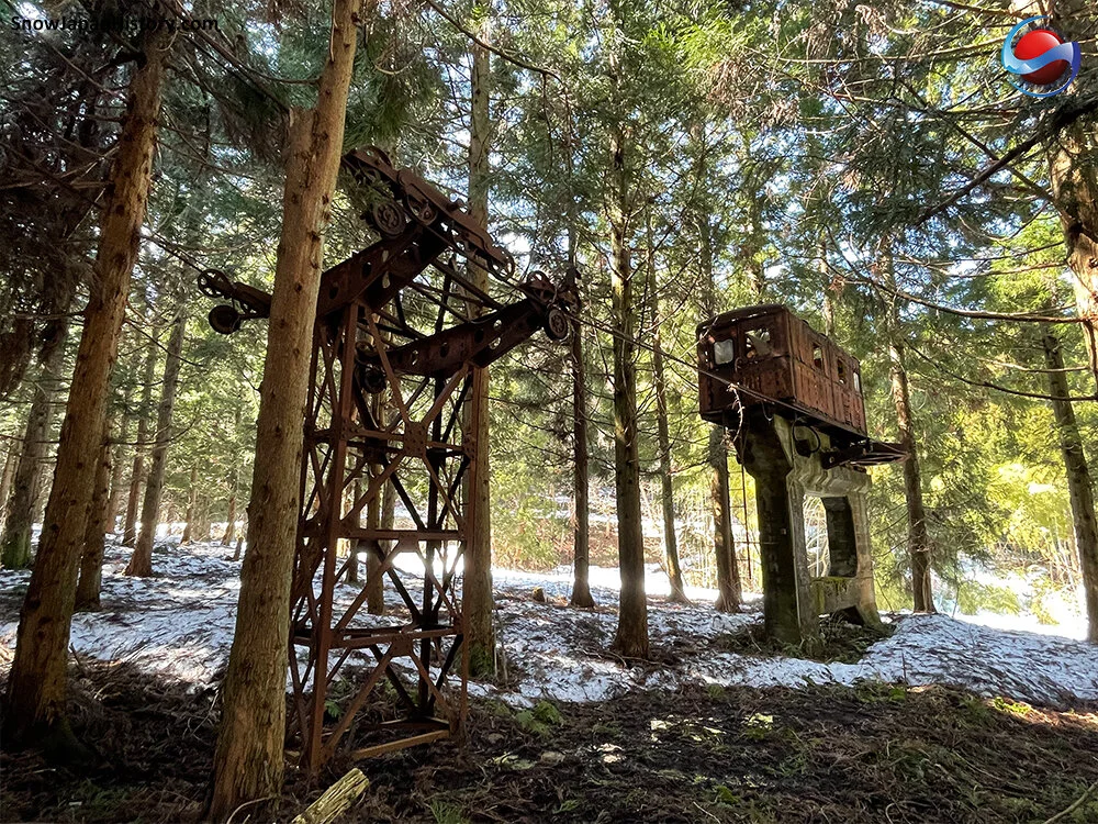
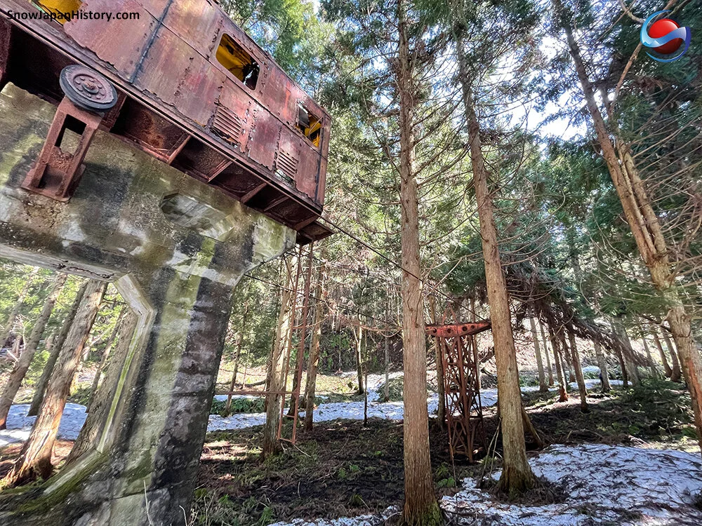
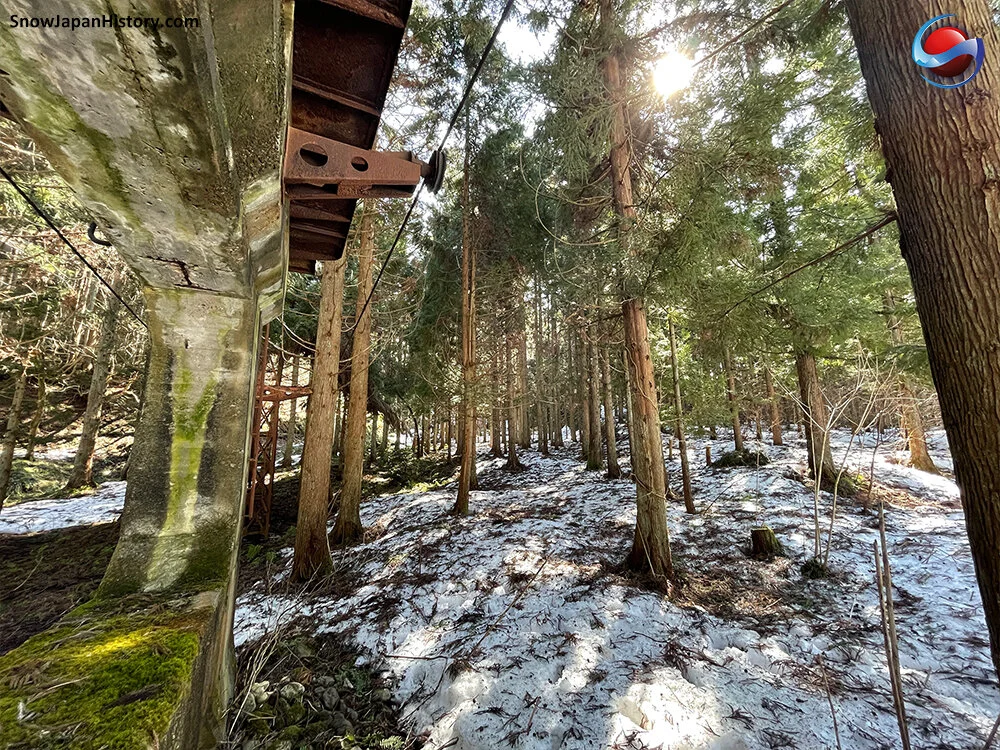
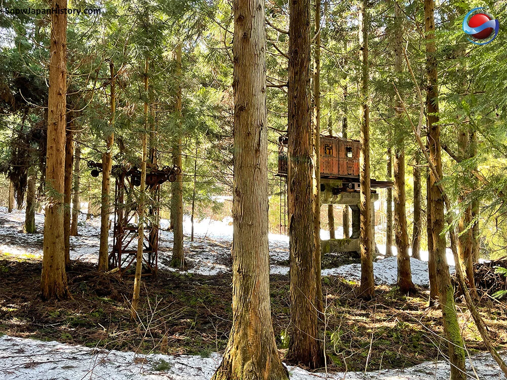
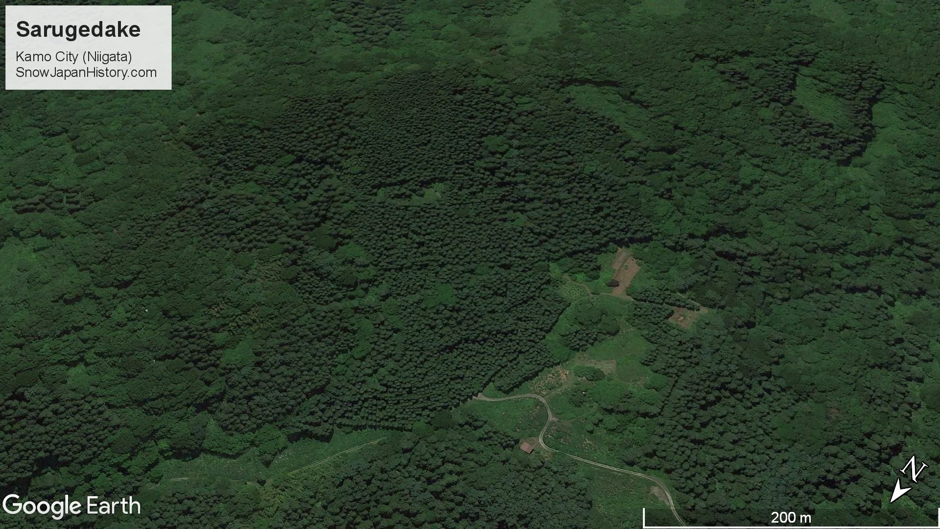
Sarugedake was a ski area located on the north western slopes of the mountain of the same name, in the Saruge neighbourhood of Kamo City in Niigata Prefecture. Sarugedake opened in the mid 1960s and closed in the late 1970s. This region of Niigata Prefecture used to receive more snow than it does now, but even back in the 1970s Sarugedake apparently struggled with limited snowfall. A hiking course on the mountain comes down through what used to be the ski slopes. The old ski lift and other facilities remain in place. They are now surrounded by forest and undergrowth, making for some very striking and unique scenery.

Sarugedake Ski Area(猿毛岳スキー場)
Opened
開設
Early 1960s
Ski lift opened January 1964
Closed
Late 1970s
Base elevation
標高最低
160m
Top elevation
標高最高
310m
Vertical
標高差
150m
Steepest slope
最大斜度
Unknown
Number of courses
コース本数
Unknown
Longest run
最長滑走距離
About 700m
Skill level
初級・中級・上級
The base area was for beginners
The top area - via the single lift - offered more challenge
Ski / board
スキー・ボード
100% / 0%
Closed before snowboarding arrived
Ski lifts
リフト本数
2 lifts
Single 450m
Rope tow 120m
The single lift remains in place
Remains of the rope tow and base also remain
Floodlit operations
ナイター設備
There were floodlit night operations

Photographs

Below is a selection of the photographs taken over two visits to Sarugedake in June 2020 and March 2021.
The complete sets of photographs and more information can be found on these pages:

Photographs from June 2020 (81 photos)
Photographs from March 2021 (42 photos)

 June 2020


 March 2021

Further Information

  • Sarugedake Ski Area appears to have been established in January 1960 by local volunteers with the opening of a rope tow lift
     
  • The local Niigata Kotsu  新潟交通  bus company became involved in order to create a more substantial ski area
     
  • Construction of the 450m single lift started in August 1963
     
  • The lift was completed in December 1963 and officially opened in January 1964
     
  • At the time Sarugedake was described as being a 'modern ski area' - the other small ski areas in the region did not feature ski lifts
     
  • Facilities included the single lift, rope tow lift, an impressive base lodge building and 8 floodlights for night skiing
     
  • The large Sarugedake Lodge building featured a large red triangular shaped roof and chimney
     
  • SARUGEDAKE LODGE was written in large English letters on the side of the building
     
  • The restaurant seated 100 people and there was even accommodation for 20 guests
     
  • In the first season of operation Sarugedake was only able to open on 31 days due to limited snowfall
     
  • In that season the ski area was visited by 16,000 people and 57 bus trips from Niigata City (which is about 35km to the north)
     
  • It had to close in 1970 due to local flooding
     
  • It re-opened again in 1971 but struggled for snowfall, eventually closing in the late 1970s
     
  • The ski slope is now almost completely covered with large trees and undergrowth
     
  • The old ski lift can be found deep within this forest
     
  • The chairs have been taken off the ski lift, but the cables remain and run from bottom to top
     
  • Parts of the rope tow lift and floodlights can also be found on the lower areas
     
  • The foundations of the Sarugedake Lodge building also remain
     
  • The Sarugedake Hiking Course  猿毛岳ハイキングコース  is a pleasant walk and popular around the year
     
  • The old ski area facilities can all be seen within (at most) a few hundred metres from the official hiking course
     
  • Sarugedake is one of the 100 famous mountains of Niigata Prefecture  新潟100名山  with a summit of 326.7m
     
  • Photographs of the old ski area and other information can be found in the mountain hut at the top, close to the remains of the ski lift
     
  • Sarugedake is a truly fascinating location and well worth a visit
     
  • More information and photographs can be found on these pages:
     
  • Photographs from June 2020
     
  • Photographs from March 2021

Google Earth

Google Street View

Google Maps

Location
所在地

The base area is about 1.5km off Prefecture Road 9, to the south east of central Kamo City.
About 19.5km from the Tsubame Sanjo IC exit of the Hokuriku Expressway.
About 5.5km from Kamo Station on the Shinetsu Honsen line.
北陸自動車道 燕三条ICから的19.5km
信越本線 加茂駅から的5.5km

Currently operating ski & snowboard resorts in the region
近隣の運営中のスキー場

All currently operating ski areas in Niigata Prefecture

This page was created in June 2020
Last updated on 11th August 2022
2020年6月 作成  2022年8月11日 更新